The Athabasca basin
The Athabasca Basin drains an area of 159,000 square kilometers. The Athabasca River is the second largest in Alberta, with almost 21 cubic kilometers of water flowing past Fort McMurray annually. Resource extraction facilities are a prominent feature in the area owing to the migration and entrapment of oil within local geological formations. These include upgraders, open pit mines and Steam Assisted Gravity Drainage (SAGD) facilities.
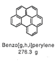
To safeguard the environment, watercourses within the basin have been intensively monitored by both federal and provincial government agencies. Water quality programs within monitor strategies measure more than 70 different Polycyclic Aromatic Hydrocarbons (PAHs). These compounds have recently garnered attention in the scientific and environmental community. This is due to their carcinogenic and mutagenic impacts on humans, fish, amphibians, and invertebrates.
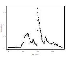
Knowing the source and timing of these releases is critical to applying mitigative strategies. PAHs are emitted from both natural and anthropogenic sources. These processes affect relative fractions within the suite of PAH chemicals. I use these fingerprints to delineate the source of potential anthropogenic PAH contamination. Additionally, I correlate releases with other environmental factors to examine the times at which increased instream concentrations are most likely. This analysis was completed using heat mapping, Principal Component Analysis (PCA), Principal Coordinate Analysis (PCoA).
This study found that the Ells and Tar rivers likely exhibit signs of industrial contamination from variable sources. To a lesser degree, the Steepbank and MacKay rivers also display some impact. The changes in PAH fingerprints occur during periods of increased run off and erosion. This suggests anthropogenic impacts may occur in upland areas and are flushed into watercourses.
To safeguard the environment, watercourses within the basin have been intensively monitored by both federal and provincial government agencies. Water quality programs within monitor strategies measure more than 70 different Polycyclic Aromatic Hydrocarbons (PAHs). These compounds have recently garnered attention in the scientific and environmental community. This is due to their carcinogenic and mutagenic impacts on humans, fish, amphibians, and invertebrates.
Knowing the source and timing of these releases is critical to applying mitigative strategies. PAHs are emitted from both natural and anthropogenic sources. These processes affect relative fractions within the suite of PAH chemicals. I use these fingerprints to delineate the source of potential anthropogenic PAH contamination. Additionally, I correlate releases with other environmental factors to examine the times at which increased instream concentrations are most likely. This analysis was completed using heat mapping, Principal Component Analysis (PCA), Principal Coordinate Analysis (PCoA).
This study found that the Ells and Tar rivers likely exhibit signs of industrial contamination from variable sources. To a lesser degree, the Steepbank and MacKay rivers also display some impact. The changes in PAH fingerprints occur during periods of increased run off and erosion. This suggests anthropogenic impacts may occur in upland areas and are flushed into watercourses.
Introduction and HistoryHere we review the ecology of the region, the industry within it, and the ongoing studies taking place. |
Sampling Methods and AnalysisWe examine what data is collect and why we collect it. |
Data A look at how we can apply the data to further our understanding . |
Results and DiscussionWhat we can learn and where can we go from here. |
This analysis has been completed as part of the University of Alberta's Renewable Resources 690 - Multivariate Statistics For Environmental Sciences course. The raw data is publicly available from Alberta Environment and Parks. Analysis is preliminary and is not intended to inform management or policy directions. Neither the University of Alberta or Brandon Hill accept any risk of liability with the use or misuse of the analysis provided.
